Giant Mountains

Elbe Source

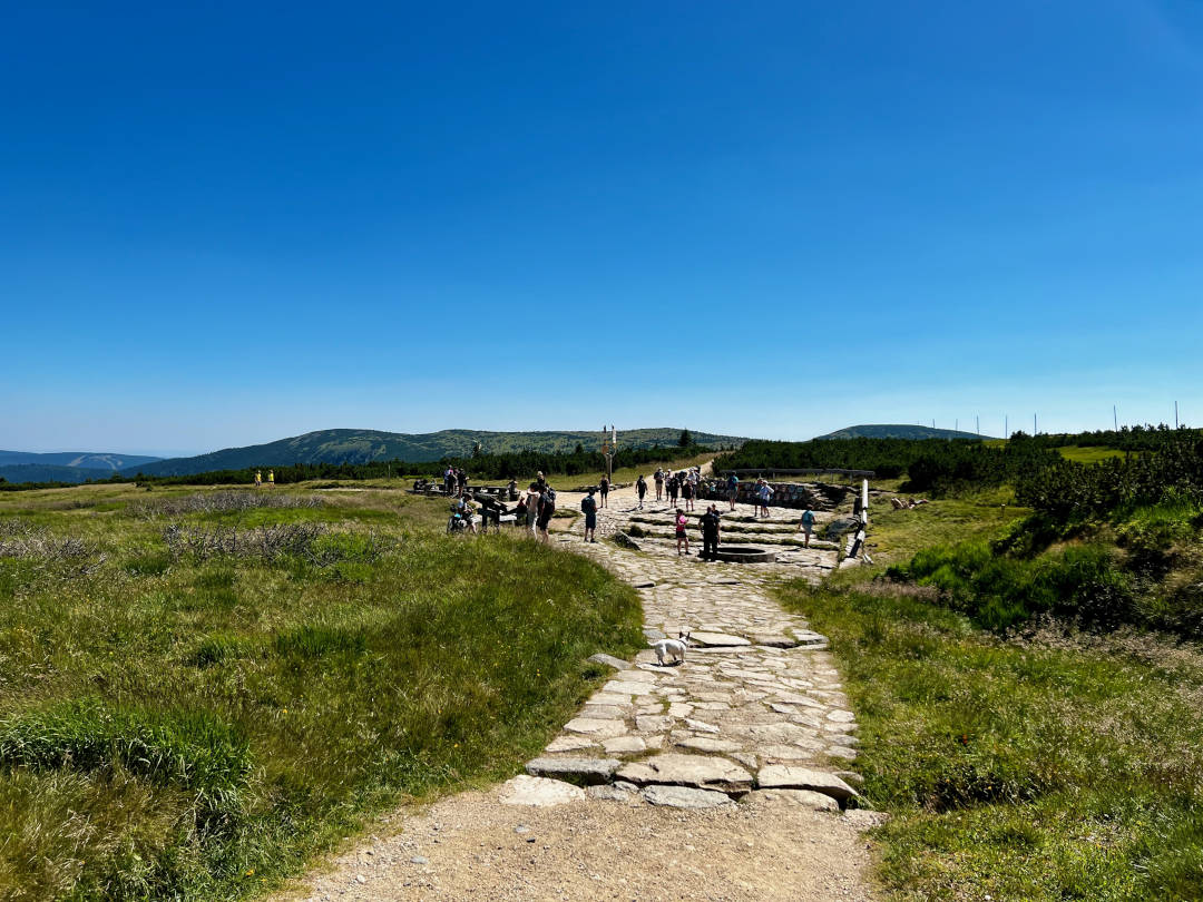
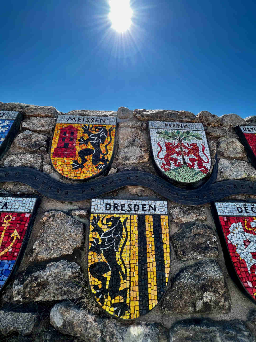
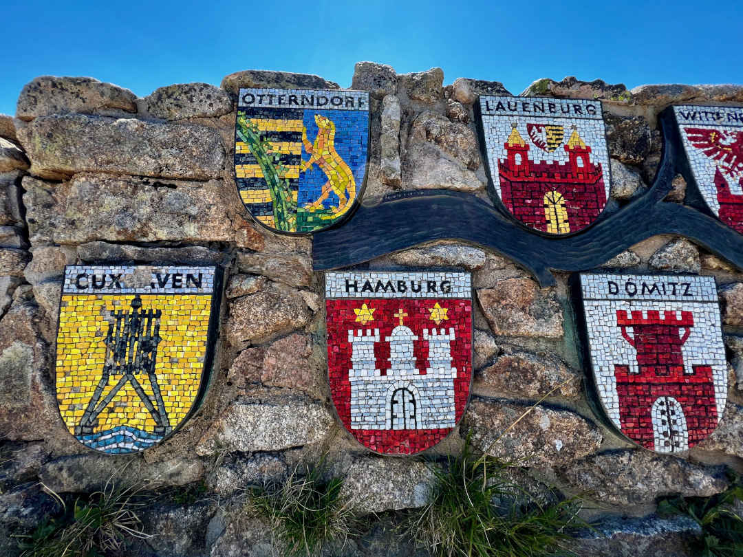
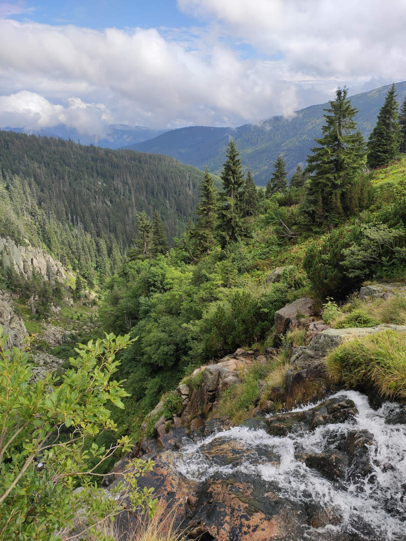
Elbe Source in the Karkonosze Mountains – the place where the largest river in the Czech Republic and one of the largest in Europe begins.

Price list

  • Karkonosze National Park entrance ticket
  • one-day regular
    11 2.6person
  • one-day reduced
    5.5 1.3person
  • children up to 7 years old
    free of charge / included
  • reduced ticket is available to: people with disabilities, students, and retirees
  • you can buy tickets online here
  • remember to keep your receipt from the ticket office or online purchase confirmation with you in case of inspection

Information

  • The source of the Elbe River (Czech: Labe, German: Elbe), the beginning of the largest river in the Czech Republic and one of the largest in Germany, is located at an altitude of 1387 m above sea level near the Polish-Czech border, about a kilometer from Labský štít (Elbe Peak).
  • The Elbe is 1165 kilometers long. Along its course, it flows through Pardubice, Hradec Králové, Dresden, Hamburg, among others, and near the city of Cuxhaven, it flows into the North Sea.
  • on site, you will find a stone circle, which is a symbolic starting point of the river. The actual source is located 300 meters to the west and is not accessible to visitors.
  • there are also tables and benches where you can rest. Next to it is a stone wall with 26 mosaic coats of arms of the cities through which the Elbe flows.
  • while you’re there, it’s worth extending your route and heading to the Elbe Waterfall, which is 1.5 km away (less than a 30-minute hike). You’ll reach it by following the red trail, then turning onto the blue trail. Along the way, you’ll pass a well-known Czech mountain hut – Labská bouda.
  • many important hiking trails intersect at the Elbe source. Within a 30-minute hike, you’ll find yourself at the iconic “Pod Łabskim Szczytem” mountain hut, and the Śnieżne Kotły are less than an hour away.
  • the shortest and easiest route starts in Szklarska Poręba, from where you can take the cable car up to Szrenica. Then, follow the green, and later the red trail. At the intersection near Czeska Budka (Czech: Česká budka), turn onto the Czech Path marked in yellow. The entire 3-kilometer route with 119 meters of elevation gain can be completed in about an hour.
  • an alternative, more difficult and longer route to the Elbe source starts in Jagniątków (PARKING), then follows the blue trail all the way to the crossroads at Czarna Przełęcz. At the intersection, follow the red trail leading to Śnieżne Kotły. Once at the summit, turn onto the yellow trail, which will take you directly to your destination. The total ascent over 7 kilometers of this route is 946 meters, and the hike will take you about 3.5 hours.
  • see more Karkonosze attractions

Frequently asked questions

Elbe Source

Coats of arms of Czech and German cities through which the Elbe flows.

Sport and activity

Wysoki Kamień

Churches and monuments, Guide

Grzybek Observation Tower in Jelenia Góra

Ski lift to Szrenica
Sport and activity

Chairlift in Szklarska Poręba – Szrenica Ski Arena

Creative Workshops, Guide, Sport and activity

Winter Break in the Land of Extinct Volcanoes

Visiting Adršpach Rocks
Volcanoes, geology, nature

Rock City in Adršpach

Snow Boilers
Volcanoes, geology, nature

Snow Boilers

Volcanoes, geology, nature

Borowa Observation Tower

Explorer's Passport
Castles and palaces, Churches and monuments, Creative Workshops, Guide, Volcanoes, geology, nature

Explorer’s Passport